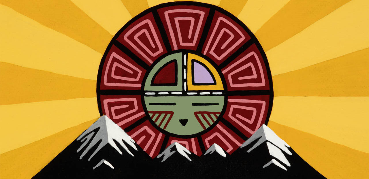
Artwork by Duane Koyawena.
Pinyons and Pines is an underground self-supported bikepacking event that starts and ends in Flagstaff, AZ (6,910 feet). The route is a magnificent tour of Northern Arizona, utilizing a mixture of singletrack, double track, and dirt roads. The start and finish are at Flagstaff Bicycle Revolution, located at 3 South Mikes Pike, sandwiched between Pizzicletta and Mother Road Brewery. The 2024 edition of Pinyons and Pines will start at 6:00AM on Thursday, May 16. This year’s route is approximately 364 miles with 31,000 feet of climbing. The ride organizers are Dana Ernst and Dylan Turner. Please contact us with any questions or concerns.
Flagstaff sits at the base of the San Francisco Peaks, on homelands sacred to Native Americans throughout the region. The Peaks, which includes Humphreys Peak (12,633 feet), the highest point in Arizona, have religious significance to several Native American tribes. In particular, the Peaks form the Diné (Navajo) sacred mountain of the west, called Dook’o’oosłííd, which means “the summit that never melts”. The Hopi name for the Peaks is Nuva’tukya’ovi, which translates to “place-of-snow-on-the-very-top”. This year’s course traverses the ancestral homelands of the Hopi, Ndee/Nnēē (Western Apache), Yavapai, A:shiwi (Zuni Pueblo), and Diné (Navajo). We honor their past, present, and future generations, who have lived here for millennia and will forever call this place home.
Riders can choose between two categories: solo or duo (2-person team). Please consult the rules prior to registering for the event. Feel free to ask questions on the event’s Facebook group.
Important! This is an unsanctioned event. There are no fees, no prizes, but all attempts will be made to record your finish time. A start time and route are provided and it is up to the participant to understand the route. Riders have full responsibility for their navigation and well being. The goal is to finish the entire route while setting your own pace.
Below are some important notes, including information concerning resupply options for food and water. All mileages are approximate.
- Please consult the rules.
- Important: Filter and/or treat all natural water sources.
- Miles 0-4.1: Neutral roll out for the first 4.1 miles. Folks can start riding at their own pace after the group crosses Hwy 180.
- Mile 17.9: Just south of tunnel that goes under Route 89, head southwest on double track to access Conoco Travel Center (open 24 hours).
- Mile 19.3: Cross Rio de Flag. Possible water source.
- Mile 35.4: Lake Mary Country Store slightly south of route just before turning right.
- Mile 50: Weimer Spring. Spring is on south side of road. Walk a short way up hill to access spring.
- Mile 58.6: Double Spring Campground water spigot (and likely small creek). Water spigot should be on.
- Mile 61.3: Mormon Lake Lodge and Store. The store does not like bikes being parked under the awning in front of the store. Please be respectful.
- Mile 98.3: Turn southwest (right) on Hwy 87 to access Happy Jack Ranger Station. Water spigot behind the main building.
- Mile 104.6: Cross East Clear Creek. Possible water source.
- Mile 139.7: Woods Canyon Lake Store and campground is about 1.5 miles off route to the north. Store hours are 8am-5pm.
- Mile 150: Cross Christopher Creek. Possible water source.
- Mile 151.8: Small town of Christopher Creek. Christopher Creek General Store makes for a nice resupply if you can time the open hours. Landmark Restaurant and Creekside Tavern are a short distance off route to the east.
- Mile 153.2: Christopher Creek Campground slightly off route to south. Water Spigot
- Mile 156.7: Kohls Ranch Lodge off route to south.
- Mile 157.5: Cross Horton Creek. Possible water source.
- Mile 174.7: Cross East Verde River. Possible water source.
- Mile 179.7: Access to East Verde River to the east. Possible water source.
- Mile 180.6: Cross small creek. Possible water source.
- Mile 185.7: Cross Sycamore Creek. Possible water source.
- Mile 191.3: Cross Weber Creek. Possible water source.
- Mile 201.3: That Brewery. Popular with AZT through hikers.
- Mile 201.9: Ponderosa Market. Open 7am-8pm (9pm on Fridays and Saturdays).
- Mile 206: Pie Bar in town of Strawberry. Worth the stop if you are there during open hours.
- Mile 211.3-221.5: No camping allowed in this section!!!
- Mile 217.1: Access to Fossil Creek. Possible water source. Water might be tough on your water filter!
- Mile 233.8: Clear Creek Campground. Access to water spigot.
- Mile 235.2: Dollar General.
- Mile 239.5: 76 Gas Station.
- Mile 242.2: McDonald’s, gas station, etc.
- Mile 274.8: Allen Spring. Water usually flowing out of a large pipe on the downhill side of the road.
- Mile 276.4: Piped spring.
- Mile 287: 24-hour Maverick.
- Mile 288.1: Verde Valley Bicycle Company. There will be a work stand and some repair supplies behind bike shop. You can also camp back there. Please thank Greg the owner and any employees for supporting us!
- Mile 289.1: 24-hour Circle K.
- Miles 312.4-315: Town of Sedona. Lots of resupply options including McDonald’s, Safeway, Whole Foods. Route also passes Thunder Mountain Bikes.
- Mile 326.8: Spigot in neighborhood gazebo just passed ADOT yard. Residents don’t seem to mind us using it, but be respectful!
- Mile 364.1: Finish at Flagstaff Bicycle Revolution. Pat yourself on the back and sign the finishers sheet located in the mailbox to the right of the door. Be happy. Pizzicletta and Mother Road Brewery on either side of FBR.